
Thank you for supporting this site ❤️
Make a donation
Make a donation
Kayuputih topographic map
Click on the map to display elevation.
Thank you for supporting this site ❤️
Make a donation
Make a donation
About this map
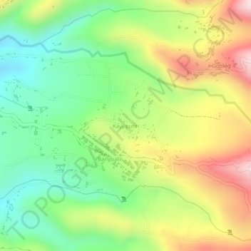
Name: Kayuputih topographic map, elevation, terrain.
Location: Kayuputih, Buleleng, Bali, Lesser Sunda Islands, Indonesia (-8.26097 115.03087 -8.25775 115.03606)
Average elevation: 500 m
Minimum elevation: 350 m
Maximum elevation: 679 m
Thank you for supporting this site ❤️
Make a donation
Make a donation
Other topographic maps
Click on a map to view its topography, its elevation and its terrain.