
月牙山 topographic map
Interactive map
Click on the map to display elevation.
About this map
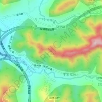
Name: 月牙山 topographic map, elevation, terrain.
Location: 月牙山, 兴隆街道, 宁阳县, 山东省, 中国 (36.56808 117.10364 36.56818 117.10374)
Average elevation: 388 m
Minimum elevation: 285 m
Maximum elevation: 589 m