
Bramsche topographic map
Interactive map
Click on the map to display elevation.
Bramsche
In Wesel, beiderseits der Bundesstraße 70 in Höhe der Mülldeponie Venneberg, befand sich der Militärflugplatz Plantlünne/Wesel mit der III./Jagdgeschwader 26. Zu Beginn des Zweiten Weltkrieges war der Flugplatz, auf dem 60 bis 120 Flugzeuge standen, einsatzfähig. Der Flughafen wurde von Strafgefangenen errichtet. Diese zogen in langen Kolonnen, von Wärtern bewacht, vom Militärflugplatz Plantlünne/Wesel zum Dortmund-Ems-Kanal, um dort mit Schaufeln und bloßen Händen Schiffsladungen mit Baustoffen und Pflastermaterial für den Flugplatzausbau auf Feldbahnloren oder Lkw zu verladen. Nach mehreren Bombardierungen nahmen die Briten am 9. April 1945 den Flugplatz in Besitz und flogen von dort aus britische Einsätze. Ein tragischer Irrtum nahm hier am 3. Mai 1945 seinen Anfang. Britische Kampfflugzeuge stiegen auf und versenkten in der Lübecker Bucht die Cap Arcona und Thielbek, auf denen sich zahlreiche KZ-Häftlinge des KZ Neuengamme befanden.
About this map
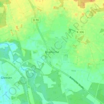
Name: Bramsche topographic map, elevation, terrain.
Average elevation: 33 m
Minimum elevation: 21 m
Maximum elevation: 51 m
Other topographic maps
Click on a map to view its topography, its elevation and its terrain.