
Wallendorf (Luppe) topographic map
Interactive map
Click on the map to display elevation.
About this map
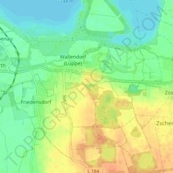
Name: Wallendorf (Luppe) topographic map, elevation, terrain.
Average elevation: 92 m
Minimum elevation: 77 m
Maximum elevation: 112 m
Other topographic maps
Click on a map to view its topography, its elevation and its terrain.
Ermlitz
Deutschland > Sachsen-Anhalt > Saalekreis > Schkopau
Ermlitz, Schkopau, Saalekreis, Sachsen-Anhalt, Deutschland
Average elevation: 107 m