
Warnow topographic map
Interactive map
Click on the map to display elevation.
Warnow
Die Gemeinde Warnow liegt am Durchbruchstal des Flusses Warnow, die unterhalb des Ortes in das Bützower Becken eintritt und bis Schwaan nach Nordosten folgt. Der westlich der Warnow gelegene Tempelberg in der Nähe des Ortsteils Eickelberg erreicht eine Höhe von 85 m ü. NN. Die Gemarkung des am Nordrand der Mecklenburgischen Seenplatte gelegenen Warnow grenzt an den Landkreis Nordwestmecklenburg und an den Landkreis Ludwigslust-Parchim.
About this map
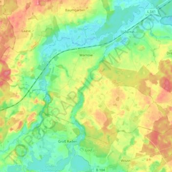
Name: Warnow topographic map, elevation, terrain.
Average elevation: 31 m
Minimum elevation: -1 m
Maximum elevation: 79 m
Other topographic maps
Click on a map to view its topography, its elevation and its terrain.