
Thank you for supporting this site ❤️
Make a donation
Make a donation
Willebadessen topographic map
Click on the map to display elevation.
Thank you for supporting this site ❤️
Make a donation
Make a donation
About this map
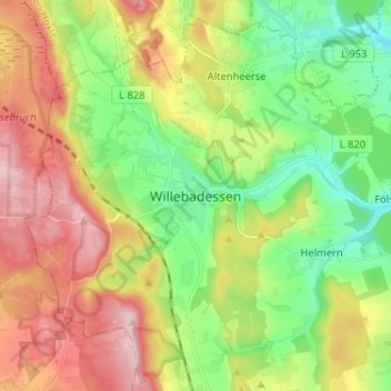
Name: Willebadessen topographic map, elevation, terrain.
Location: Willebadessen, Kreis Höxter, Nordrhein-Westfalen, Deutschland (51.58578 8.99426 51.66578 9.07426)
Average elevation: 288 m
Minimum elevation: 180 m
Maximum elevation: 436 m
Thank you for supporting this site ❤️
Make a donation
Make a donation