
Brock Island topographic map
Interactive map
Click on the map to display elevation.
About this map
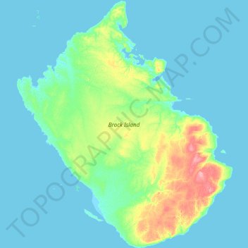
Name: Brock Island topographic map, elevation, terrain.
Location: Brock Island, Northwest Territories, Canada (77.70613 -115.10481 78.08022 -113.54875)
Average elevation: 9 m
Minimum elevation: -2 m
Maximum elevation: 83 m
Other topographic maps
Click on a map to view its topography, its elevation and its terrain.