
Thank you for supporting this site ❤️
Make a donation
Make a donation
Isla Santay topographic map
Click on the map to display elevation.
Thank you for supporting this site ❤️
Make a donation
Make a donation
About this map
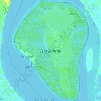
Name: Isla Santay topographic map, elevation, terrain.
Location: Isla Santay, Duran, Durán, Guayas, 090512, Ecuador (-2.25403 -79.87800 -2.19359 -79.83349)
Average elevation: 4 m
Minimum elevation: -5 m
Maximum elevation: 26 m
Thank you for supporting this site ❤️
Make a donation
Make a donation
Other topographic maps
Click on a map to view its topography, its elevation and its terrain.