
Steimke topographic map
Interactive map
Click on the map to display elevation.
About this map
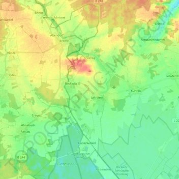
Name: Steimke topographic map, elevation, terrain.
Average elevation: 68 m
Minimum elevation: 49 m
Maximum elevation: 99 m
Other topographic maps
Click on a map to view its topography, its elevation and its terrain.
Ristedt
Deutschland > Sachsen-Anhalt > Altmarkkreis Salzwedel > Klötze
Ristedt, Klötze, Altmarkkreis Salzwedel, Sachsen-Anhalt, Deutschland
Average elevation: 53 m