
Thank you for supporting this site ❤️
Make a donation
Make a donation
Beerberg topographic map
Click on the map to display elevation.
Thank you for supporting this site ❤️
Make a donation
Make a donation
About this map
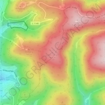
Name: Beerberg topographic map, elevation, terrain.
Location: Beerberg, Suhl, Thuringia, 98527, Germany (50.60448 10.73505 50.60458 10.73515)
Average elevation: 685 m
Minimum elevation: 490 m
Maximum elevation: 843 m
Thank you for supporting this site ❤️
Make a donation
Make a donation