
Bordaxuria topographic map
Interactive map
Click on the map to display elevation.
About this map
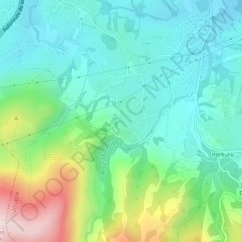
Name: Bordaxuria topographic map, elevation, terrain.
Average elevation: 149 m
Minimum elevation: 24 m
Maximum elevation: 481 m
Other topographic maps
Click on a map to view its topography, its elevation and its terrain.
Col d'Ibardin
France > Nouvelle-Aquitaine > Urrugne > Trabenea
Col d'Ibardin, D 404, Urrugne, Bayonne, Pyrénées-Atlantiques, Nouvelle-Aquitaine, France métropolitaine, 64700, France
Average elevation: 293 m
Xapel Baïta
France > Nouvelle-Aquitaine > Urrugne > Xapel Baïta
Xapel Baïta, Urrugne, Bayonne, Pyrénées-Atlantiques, Nouvelle-Aquitaine, France métropolitaine, 64700, France
Average elevation: 41 m