
Zellerhorn topographic map
Interactive map
Click on the map to display elevation.
About this map
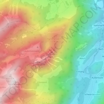
Name: Zellerhorn topographic map, elevation, terrain.
Average elevation: 1,022 m
Minimum elevation: 626 m
Maximum elevation: 1,471 m
Other topographic maps
Click on a map to view its topography, its elevation and its terrain.
Haindorf
Deutschland > Bayern > Aschau im Chiemgau > Haindorf
Haindorf, Aschau im Chiemgau, Landkreis Rosenheim, Bayern, 83229, Deutschland
Average elevation: 698 m