
Thank you for supporting this site ❤️
Make a donation
Make a donation
Mount Gamalama topographic map
Click on the map to display elevation.
Thank you for supporting this site ❤️
Make a donation
Make a donation
About this map
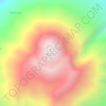
Name: Mount Gamalama topographic map, elevation, terrain.
Location: Mount Gamalama, Ternate, North Maluku, Maluku, Indonesia (0.80983 127.33229 0.80993 127.33239)
Average elevation: 1,228 m
Minimum elevation: 512 m
Maximum elevation: 1,704 m
Thank you for supporting this site ❤️
Make a donation
Make a donation
Other topographic maps
Click on a map to view its topography, its elevation and its terrain.