
Rubirizi topographic map
Interactive map
Click on the map to display elevation.
About this map
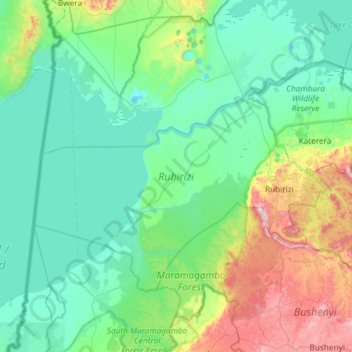
Name: Rubirizi topographic map, elevation, terrain.
Location: Rubirizi, Western Region, Uganda (-0.44893 29.69853 -0.06299 30.28569)
Average elevation: 1,067 m
Minimum elevation: 878 m
Maximum elevation: 1,847 m
Other topographic maps
Click on a map to view its topography, its elevation and its terrain.