
South Island topographic map
Interactive map
Click on the map to display elevation.
About this map
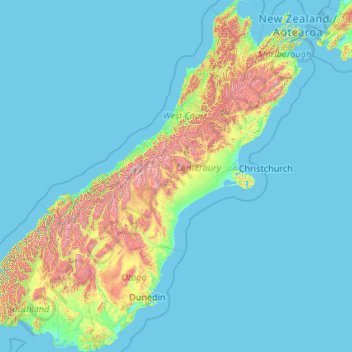
Name: South Island topographic map, elevation, terrain.
Location: South Island, Ashburton District, Canterbury, New Zealand (-46.67550 166.42555 -40.49786 174.31586)
Average elevation: 201 m
Minimum elevation: -1 m
Maximum elevation: 2,987 m
Other topographic maps
Click on a map to view its topography, its elevation and its terrain.