
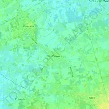
Sint-Pauwels topographic map
Interactive map
Click on the map to display elevation.
About this map
Name: Sint-Pauwels topographic map, elevation, terrain.
Average elevation: 7 m
Minimum elevation: 1 m
Maximum elevation: 17 m
Sint-Pauwels ligt in Zandig Vlaanderen en in het Waasland. De hoogte varieert van 5 tot 11 meter.
Other topographic maps
Click on a map to view its topography, its elevation and its terrain.
De Klinge
België > Oost-Vlaanderen > Sint-Niklaas > Sint-Gillis-Waas
De Klinge, Sint-Gillis-Waas, Sint-Niklaas, Oost-Vlaanderen, België
Average elevation: 3 m
Meerdonk
België > Oost-Vlaanderen > Sint-Niklaas > Sint-Gillis-Waas
Meerdonk, Sint-Gillis-Waas, Sint-Niklaas, Oost-Vlaanderen, België
Average elevation: 1 m