
Vaqueiros topographic map
Interactive map
Click on the map to display elevation.
About this map
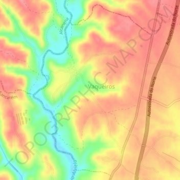
Name: Vaqueiros topographic map, elevation, terrain.
Location: Vaqueiros, Casével e Vaqueiros, Santarém, Alentejo, Portugal (39.39723 -8.65942 39.42290 -8.63631)
Average elevation: 86 m
Minimum elevation: 36 m
Maximum elevation: 115 m
Other topographic maps
Click on a map to view its topography, its elevation and its terrain.