
琼孜乡 topographic map
Interactive map
Click on the map to display elevation.
About this map
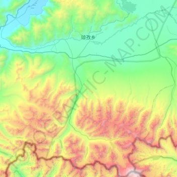
Name: 琼孜乡 topographic map, elevation, terrain.
Location: 琼孜乡, 定结县, 日喀则市, 西藏自治区, 中国 (27.86736 87.80867 28.30546 88.24966)
Average elevation: 5,144 m
Minimum elevation: 4,201 m
Maximum elevation: 7,452 m
Other topographic maps
Click on a map to view its topography, its elevation and its terrain.