
Kwun Tong Tsai Wan topographic map
Interactive map
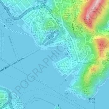
Click on the map to display elevation.
About this map
Name: Kwun Tong Tsai Wan topographic map, elevation, terrain.
Average elevation: 43 m
Minimum elevation: 0 m
Maximum elevation: 268 m
Other topographic maps
Click on a map to view its topography, its elevation and its terrain.
On Li Sai Tsuen
On Li Sai Tsuen, Kwun Tong District, Hong Kong, SIL 739, PRC
Average elevation: 39 m