
Thank you for supporting this site ❤️
Make a donation
Make a donation
Del Rio topographic map
Click on the map to display elevation.
Thank you for supporting this site ❤️
Make a donation
Make a donation
About this map
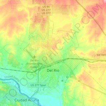
Name: Del Rio topographic map, elevation, terrain.
Location: Del Rio, Val Verde County, Texas, United States (29.32516 -100.93644 29.42836 -100.80187)
Average elevation: 310 m
Minimum elevation: 263 m
Maximum elevation: 370 m
Thank you for supporting this site ❤️
Make a donation
Make a donation