
Thank you for supporting this site ❤️
Make a donation
Make a donation
Lijin County topographic map
Click on the map to display elevation.
Thank you for supporting this site ❤️
Make a donation
Make a donation
About this map
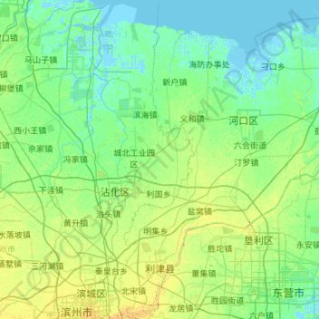
Name: Lijin County topographic map, elevation, terrain.
Location: Lijin County, Dongying, Shandong, 257400, China (37.36156 118.10652 38.19880 118.70620)
Average elevation: 5 m
Minimum elevation: -3 m
Maximum elevation: 23 m
Thank you for supporting this site ❤️
Make a donation
Make a donation
Other topographic maps
Click on a map to view its topography, its elevation and its terrain.