
Thank you for supporting this site ❤️
Make a donation
Make a donation
Nambung topographic map
Click on the map to display elevation.
Thank you for supporting this site ❤️
Make a donation
Make a donation
About this map
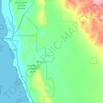
Name: Nambung topographic map, elevation, terrain.
Location: Nambung, Shire Of Dandaragan, Western Australia, Australia (-30.68647 115.07475 -30.39192 115.35031)
Average elevation: 60 m
Minimum elevation: 0 m
Maximum elevation: 289 m
Thank you for supporting this site ❤️
Make a donation
Make a donation
Other topographic maps
Click on a map to view its topography, its elevation and its terrain.