
柏洋乡 topographic map
Interactive map
Click on the map to display elevation.
About this map
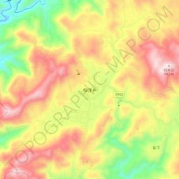
Name: 柏洋乡 topographic map, elevation, terrain.
Location: 柏洋乡, 霞浦县, 宁德市, 福建省, 中国 (27.01465 119.82558 27.09465 119.90558)
Average elevation: 566 m
Minimum elevation: 121 m
Maximum elevation: 978 m
Other topographic maps
Click on a map to view its topography, its elevation and its terrain.