
Kijang topographic map
Interactive map
Click on the map to display elevation.
About this map
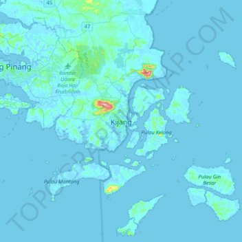
Name: Kijang topographic map, elevation, terrain.
Location: Kijang, Bintan, Riau Islands, 29151, Indonesia (0.69019 104.44275 1.01019 104.76275)
Average elevation: 5 m
Minimum elevation: -6 m
Maximum elevation: 201 m
Other topographic maps
Click on a map to view its topography, its elevation and its terrain.
Bintan Island
Indonesia > Riau Islands > Bintan
Bintan Island, Bintan, Riau Islands, Indonesia
Average elevation: 6 m