
Le Noyer Chu topographic map
Interactive map
Click on the map to display elevation.
About this map
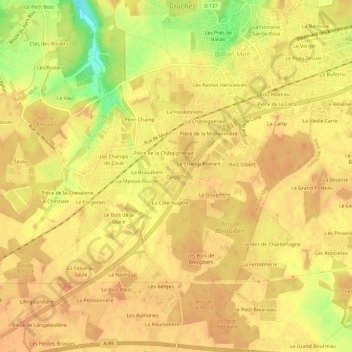
Name: Le Noyer Chu topographic map, elevation, terrain.
Average elevation: 92 m
Minimum elevation: 60 m
Maximum elevation: 102 m
Other topographic maps
Click on a map to view its topography, its elevation and its terrain.
L’Etape
France > Centre-Val de Loire > Indre-et-Loire > Ballan-Miré
L’Etape, Le Petit Bouchet, Ballan-Miré, Tours, Indre-et-Loire, Centre-Val de Loire, France métropolitaine, 37510, France
Average elevation: 61 m