Paramount-Long Meadow topographic map
Interactive map
Click on the map to display elevation.
About this map
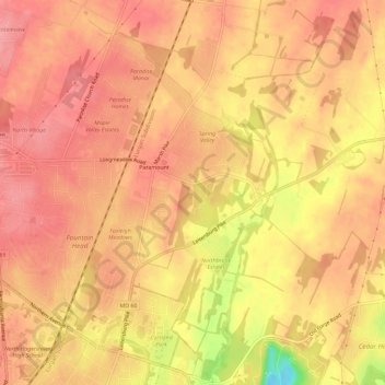
Name: Paramount-Long Meadow topographic map, elevation, terrain.
Average elevation: 177 m
Minimum elevation: 104 m
Maximum elevation: 203 m

Click on the map to display elevation.
Name: Paramount-Long Meadow topographic map, elevation, terrain.
Average elevation: 177 m
Minimum elevation: 104 m
Maximum elevation: 203 m