
攀莲镇 topographic map
Interactive map
Click on the map to display elevation.
About this map
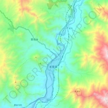
Name: 攀莲镇 topographic map, elevation, terrain.
Location: 攀莲镇, 米易县, 攀枝花市, 四川省, 中国 (26.83463 102.04287 26.99456 102.22882)
Average elevation: 1,657 m
Minimum elevation: 1,060 m
Maximum elevation: 3,379 m