
Lövlund topographic map
Interactive map
Click on the map to display elevation.
About this map
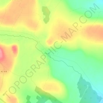
Name: Lövlund topographic map, elevation, terrain.
Location: Lövlund, Skellefteå kommun, Västerbotten County, Sweden (64.79422 20.77074 64.83422 20.81074)
Average elevation: 100 m
Minimum elevation: 63 m
Maximum elevation: 143 m