
Tembong topographic map
Interactive map
Click on the map to display elevation.
About this map
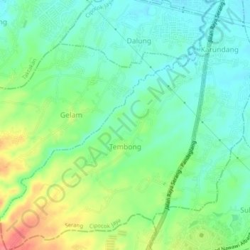
Name: Tembong topographic map, elevation, terrain.
Location: Tembong, Cipocok Jaya, Serang, Banten, Indonesia (-6.17474 106.12789 -6.13647 106.16222)
Average elevation: 58 m
Minimum elevation: 34 m
Maximum elevation: 103 m