
Thank you for supporting this site ❤️
Make a donation
Make a donation
Villaggio Zomaro topographic map
Click on the map to display elevation.
Thank you for supporting this site ❤️
Make a donation
Make a donation
About this map
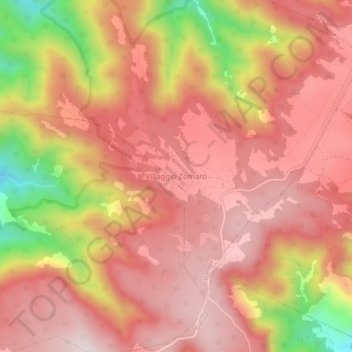
Name: Villaggio Zomaro topographic map, elevation, terrain.
Location: Villaggio Zomaro, Cittanova, Reggio Calabria, Calabria, Italia (38.28946 16.08699 38.32946 16.12699)
Average elevation: 847 m
Minimum elevation: 472 m
Maximum elevation: 1,030 m
Thank you for supporting this site ❤️
Make a donation
Make a donation