
Mulia topographic map
Interactive map
Click on the map to display elevation.
About this map
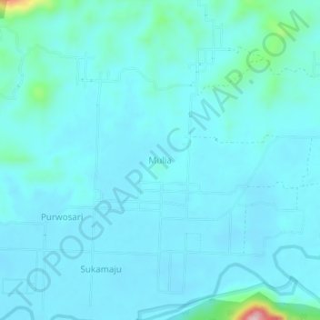
Name: Mulia topographic map, elevation, terrain.
Location: Mulia, Gorontalo, Indonesia (0.63000 121.84040 0.67000 121.88040)
Average elevation: 43 m
Minimum elevation: 18 m
Maximum elevation: 265 m