
Le Flore topographic map
Interactive map
Click on the map to display elevation.
About this map
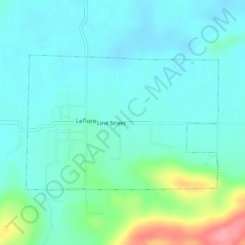
Name: Le Flore topographic map, elevation, terrain.
Location: Le Flore, Le Flore County, Oklahoma, 74942, United States (34.89107 -94.98829 34.90599 -94.96243)
Average elevation: 174 m
Minimum elevation: 153 m
Maximum elevation: 253 m
Other topographic maps
Click on a map to view its topography, its elevation and its terrain.
Leflore
United States > Oklahoma > Le Flore County > Le Flore
Leflore, Le Flore, Le Flore County, Oklahoma, 74942, United States
Average elevation: 175 m