
Auth Village topographic map
Interactive map
Click on the map to display elevation.
About this map
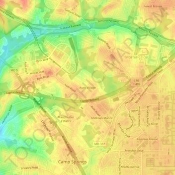
Name: Auth Village topographic map, elevation, terrain.
Average elevation: 77 m
Minimum elevation: 47 m
Maximum elevation: 91 m
Other topographic maps
Click on a map to view its topography, its elevation and its terrain.
Andrews Manor
United States > Maryland > Prince George's County > Camp Springs
Andrews Manor, Camp Springs, Prince George's County, Maryland, 20762, United States
Average elevation: 79 m
Camp Springs
United States > Maryland > Prince George's County > Camp Springs
Camp Springs, Prince George's County, Maryland, 20746, United States
Average elevation: 72 m