
Warren Dunes State Park topographic map
Interactive map
Click on the map to display elevation.
About this map
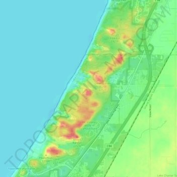
Name: Warren Dunes State Park topographic map, elevation, terrain.
Average elevation: 191 m
Minimum elevation: 172 m
Maximum elevation: 235 m
Other topographic maps
Click on a map to view its topography, its elevation and its terrain.
Weko Beach
United States > Michigan > Berrien County > Bridgman
Weko Beach, Bridgman, Berrien County, Michigan, United States
Average elevation: 186 m