
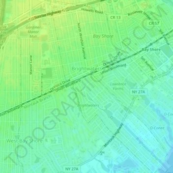
Village of Brightwaters topographic map
Interactive map
Click on the map to display elevation.
About this map
Name: Village of Brightwaters topographic map, elevation, terrain.
Average elevation: 8 m
Minimum elevation: -1 m
Maximum elevation: 15 m
Other topographic maps
Click on a map to view its topography, its elevation and its terrain.
Baywood
United States > New York > Suffolk County > Town of Islip
Baywood, Town of Islip, Suffolk County, New York, United States
Average elevation: 21 m
Bayport
United States > New York > Suffolk County > Town of Islip
Bayport, Town of Islip, Suffolk County, New York, 11705, United States
Average elevation: 8 m
West Sayville
United States > New York > Suffolk County > Town of Islip
West Sayville, Town of Islip, Suffolk County, New York, 11796, United States
Average elevation: 5 m