
Harrison County topographic map
Interactive map
Click on the map to display elevation.
About this map
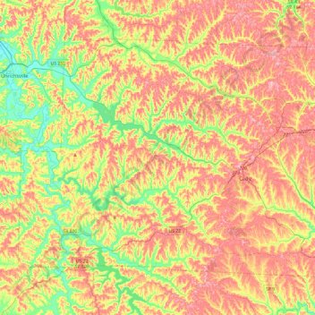
Name: Harrison County topographic map, elevation, terrain.
Location: Harrison County, Ohio, United States (40.15952 -81.33966 40.43340 -80.86513)
Average elevation: 332 m
Minimum elevation: 252 m
Maximum elevation: 408 m
Other topographic maps
Click on a map to view its topography, its elevation and its terrain.
Washington Court House
United States > Ohio > Fayette County
Washington Court House, Fayette County, Ohio, 43160, United States
Average elevation: 298 m
Cleveland
United States > Ohio > Cuyahoga County > Cleveland
Cleveland, Cuyahoga County, Ohio, 44113, United States
Average elevation: 221 m