
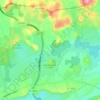
Le Caylar topographic map
Interactive map
Click on the map to display elevation.
About this map
Name: Le Caylar topographic map, elevation, terrain.
Average elevation: 751 m
Minimum elevation: 696 m
Maximum elevation: 877 m
Other topographic maps
Click on a map to view its topography, its elevation and its terrain.
Saint-Privat
Saint-Privat, Lodève, Hérault, Occitania, Metropolitan France, 34700, France
Average elevation: 481 m