
Double Island topographic map
Interactive map
Click on the map to display elevation.
About this map
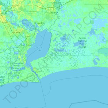
Name: Double Island topographic map, elevation, terrain.
Location: Double Island, Cameron Parish, Louisiana, USA (29.52494 -94.06072 30.16494 -93.42072)
Average elevation: 1 m
Minimum elevation: -6 m
Maximum elevation: 14 m
Other topographic maps
Click on a map to view its topography, its elevation and its terrain.