
Sai Kung East Country Park topographic map
Interactive map
Click on the map to display elevation.
About this map
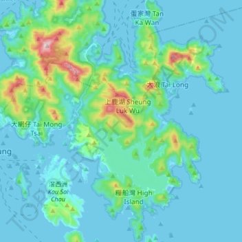
Name: Sai Kung East Country Park topographic map, elevation, terrain.
Average elevation: 62 m
Minimum elevation: -5 m
Maximum elevation: 466 m
Other topographic maps
Click on a map to view its topography, its elevation and its terrain.
High Island Reservoir
High Island Reservoir, Sai Kung Man Yee Road, High Island, Lan Nai Wan, Sai Kung District, Hong Kong, PRC
Average elevation: 78 m