
El Jorullo. topographic map
Interactive map
Click on the map to display elevation.
About this map
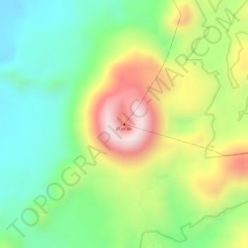
Name: El Jorullo. topographic map, elevation, terrain.
Location: El Jorullo., Ario, Michoacán, Mexico (18.97314 -101.71826 18.97324 -101.71816)
Average elevation: 969 m
Minimum elevation: 780 m
Maximum elevation: 1,224 m
Other topographic maps
Click on a map to view its topography, its elevation and its terrain.