
Fun Chau topographic map
Interactive map
Click on the map to display elevation.
About this map
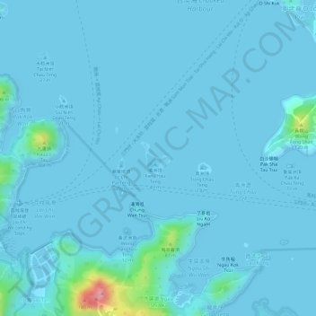
Name: Fun Chau topographic map, elevation, terrain.
Location: Fun Chau, Ngau Shi Wu, North District, Hong Kong, PRC (22.53201 114.27454 22.53491 114.27736)
Average elevation: 7 m
Minimum elevation: -1 m
Maximum elevation: 119 m