
Archangel Island topographic map
Interactive map
Click on the map to display elevation.
About this map
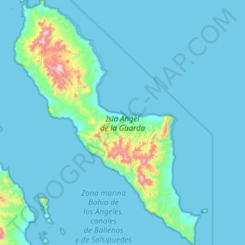
Name: Archangel Island topographic map, elevation, terrain.
Location: Archangel Island, Mexicali, Baja California, Mexico (28.98680 -113.59407 29.55184 -113.10067)
Average elevation: 71 m
Minimum elevation: -2 m
Maximum elevation: 1,049 m