
Jiading District topographic map
Interactive map
Click on the map to display elevation.
About this map
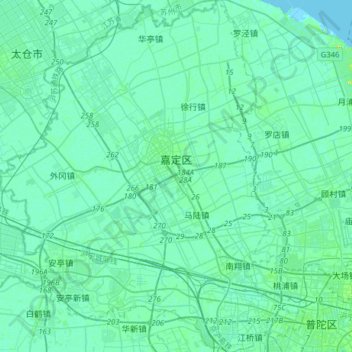
Name: Jiading District topographic map, elevation, terrain.
Location: Jiading District, Shanghai, PRC (31.22908 121.10193 31.49905 121.37630)
Average elevation: 4 m
Minimum elevation: -1 m
Maximum elevation: 8 m
Other topographic maps
Click on a map to view its topography, its elevation and its terrain.
Chongming Island
Chongming Island, Chongming, Chongming District, Shanghai, 202150, PRC
Average elevation: 3 m