
Larimer County topographic map
Interactive map
Click on the map to display elevation.
About this map
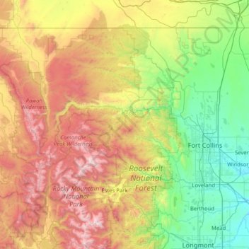
Name: Larimer County topographic map, elevation, terrain.
Location: Larimer County, Colorado, United States of America (40.25817 -106.19544 40.99824 -104.94190)
Average elevation: 2,363 m
Minimum elevation: 1,442 m
Maximum elevation: 4,281 m
Other topographic maps
Click on a map to view its topography, its elevation and its terrain.
Boulder County
United States of America > Colorado
Boulder County, Colorado, United States of America
Average elevation: 2,309 m