
Mont Habitant topographic map
Interactive map
Click on the map to display elevation.
About this map
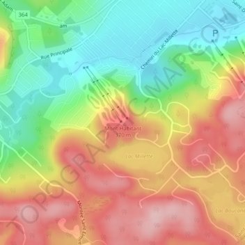
Name: Mont Habitant topographic map, elevation, terrain.
Average elevation: 297 m
Minimum elevation: 199 m
Maximum elevation: 395 m
Other topographic maps
Click on a map to view its topography, its elevation and its terrain.
Roulottes-des-Monts
Canada > Québec > Saint-Sauveur
Roulottes-des-Monts, Saint-Sauveur, Les Pays-d'en-Haut, Laurentides, Québec, J0R 1R2, Canada
Average elevation: 273 m