
Major Island topographic map
Interactive map
Click on the map to display elevation.
About this map
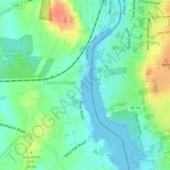
Name: Major Island topographic map, elevation, terrain.
Location: Major Island, New London County, Connecticut, USA (41.35966 -71.83946 41.36025 -71.83902)
Average elevation: 16 m
Minimum elevation: -2 m
Maximum elevation: 48 m
Other topographic maps
Click on a map to view its topography, its elevation and its terrain.
Morrison Hill
USA > Connecticut > Hartland
Morrison Hill, Hartland, Hartford County, Connecticut, 06091, USA
Average elevation: 289 m
New Haven
USA > Connecticut > New Haven
New Haven, New Haven County, Connecticut, USA
Average elevation: 20 m