
Xin'an topographic map
Interactive map
Click on the map to display elevation.
About this map
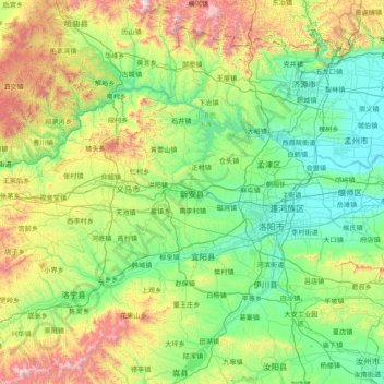
Name: Xin'an topographic map, elevation, terrain.
Location: Xin'an, Luoyang City, Henan, PRC (34.09050 111.48777 35.37050 112.76777)
Average elevation: 531 m
Minimum elevation: 106 m
Maximum elevation: 2,065 m
Other topographic maps
Click on a map to view its topography, its elevation and its terrain.