
Port Howard topographic map
Interactive map
Click on the map to display elevation.
About this map
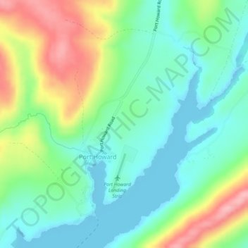
Name: Port Howard topographic map, elevation, terrain.
Location: Port Howard, Islas Malvinas, Falkland Islands (-51.61939 -59.53072 -51.59701 -59.49045)
Average elevation: 45 m
Minimum elevation: 0 m
Maximum elevation: 136 m