
20th Arrondissement topographic map
Interactive map
Click on the map to display elevation.
About this map
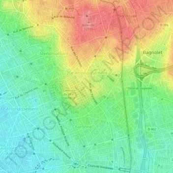
Name: 20th Arrondissement topographic map, elevation, terrain.
Location: 20th Arrondissement, Paris, Metropolitan France, 75020, France (48.84661 2.37697 48.87843 2.41644)
Average elevation: 79 m
Minimum elevation: 39 m
Maximum elevation: 135 m
Other topographic maps
Click on a map to view its topography, its elevation and its terrain.