
Peach Mountain topographic map
Interactive map
Click on the map to display elevation.
About this map
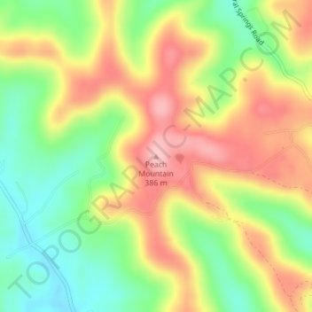
Name: Peach Mountain topographic map, elevation, terrain.
Location: Peach Mountain, Adams County, Ohio, USA (38.89530 -83.36190 38.89540 -83.36180)
Average elevation: 302 m
Minimum elevation: 224 m
Maximum elevation: 382 m
Other topographic maps
Click on a map to view its topography, its elevation and its terrain.
Ottokee Station
USA > Ohio > Ottokee Station
Ottokee Station, Fulton County, Ohio, 43567, USA
Average elevation: 239 m
Burton Lake
USA > Ohio > Burton Lake
Burton Lake, Burton Township, Geauga County, Ohio, 44021, USA
Average elevation: 348 m
Cheviot Hills
USA > Ohio > Cheviot Hills
Cheviot Hills, Clark County, Ohio, 45505, USA
Average elevation: 321 m